Mobile Laser Scans
ZAHA
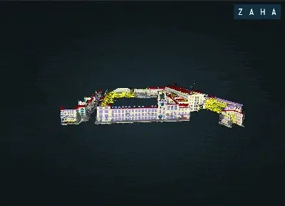
To date, the largest point cloud facade dataset boasting 601 mln points and realizing the Level of Facade Generalization (LoFG) concept, underlining the importance of hierarchical facade understanding.
To learn more see the WACV’25-accepted paper or the project repo!
Overview of the ZAHA classes and annotated point clouds
Download here
TUM-FAÇADE
MLS point clouds with facade-level labels (i.e., windows, doors, balconies, moldings, etc.) boasting 333 mln labeled points; file names and IDs are corresponding to Semantic 3D Building Models more info here.
Annotated point cloud of building DEBY_LOD2_4959457 streamed via envis.space. More facade visuals
Download here or with rsync:
rsync rsync://m1636761.003@dataserv.ub.tum.de/m1636761.003/password:
m1636761.003TUM-MLS-2016
MLS point clouds with urban-level labels (i.e., building, vehicle, vegetation, etc.) boasting 1,735 BN points; more info here and here.
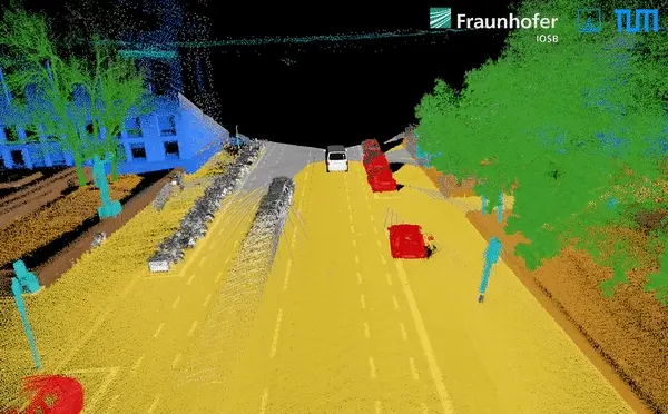
Interactive 3D visualisation (selected region)
Download a sample here or send an email to get the full access.
TUM-MLS-2018
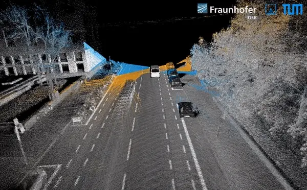
MLS point clouds with urban-level labels (i.e., building, vehicle, vegetation, etc.) boasting 2 BN points; more info here and here.
Download a sample here or send an email to get the full access.
TUM-MLS-2024
Download a sample here.